THE STORY OF SIMON’S TOWN
Introduction
The part which Simon’s Town has played in maritime strategy is inseparable from that of the Cape of Good Hope and South Africa as a whole. Close to the meeting point of the two great oceans, the Atlantic and the Indian, is a key point in world naval strategy: it is the focal point of maritime trade between East and West. Inevitably it followed that the two good anchorages, Table Bay and Simon’s Bay, became important havens for shipping. The dangers of the Table Bay anchorage during the winter months were quickly and forcibly brought to the notice of seafarers, but were tolerated when the callers were few. As ships began to frequent Table Bay in increasing numbers at all seasons of the year the incidence of ship-wrecks during the winter became greater than could be borne with equanimity..
Contents
Introduction
Simon Van der Stel names the bay
France Controls the Cape
Two British Occupations
R.N. Base moves to Simon’s Town
A period of peace
Coastal Skirmishes
Steam ships in the Dock Yard
The Anglo Boer War
East Dock Yard opened
Simon’s Town during World War I
At war again
Postwar Simon’s Town
Simon van der Stel names bay

Simon van der Stel
(Image ST Museum)
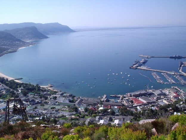
The False Bay side of the Cape Peninsula, sheltered from the violent northwest gales, was the obvious winter alternative and Simon’s Bay was selected by Simon van der Stel himself as the safest anchorage. For many years to come there were no facilities for visiting ships and communications with Cape Town were exceedingly difficult. In spite of the greater safety in winter, captains of ships tended to avoid calling there whenever possible, preferring to risk the greater danger of Table Bay in order to enjoy the superior amenities of Cape Town.
France controls the Cape
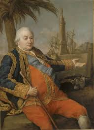
Admiral Sufferin Commander of the French Fleet that landed Troops in False Bay 1781
(Image SAMHS)
In 1650 the Dutch East India company decreed that a permanent settlement should be established at the Cape solely as a post for the replenishment of the Company’s vessels on the passage to and from the East Indies. At no time was it ever intended to gain any military advantage for which there was no necessity at that period. The Cape of Good Hope only began to assume importance as a strategic point in the military sense with the increasing rivalry between France and Great Britain in the latter half of the eighteenth century, In 1780 when Holland entered the War of American Independence in alliance with France and Spain against Great Britain, the British Government had become aware what a menace the Cape of Good Hope in the hands of an enemy could be to its trade with India. It was soon decided that an attempt must be made to capture the Cape to deny its use to the enemy. The first attempt under Commodore Johnstone suffered so many delays that the French were able to forestall him and reinforce the defences too strongly to admit of successful attack. During the next decade these dilatory methods cost Great Britain dear. With the Cape under their control the French were enabled to greatly increase their depredations on the British ships trading between India and Europe. Relief only came with the termination of hostilities when the French troops returned to Europe. With the outbreak of the Revolutionary War in 1793 the Directors of the East India Company were not unnaturally nervous about the consequences of the Cape once again falling into the hands of the French. The occupation of Holland by the Revolutionary armies in the winter of 1794/5 brought matters to a head and called for action.
Two British Occupations
First Occupation
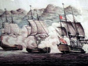
The First Occupation
The British Fleet under Admiral Elphinstone at the Battle of Muizenberg 1795
(Image ST Museum)
The British Admiralty lost no time in preparing an expedition for the occupation of the Cape, which object was successfully accomplished in 1795. The Netherlands government (in its new republican form) at last realised that an occupation of the Cape by a hostile power posed a very real threat to communications with Batavia, With a well-situated base to work from the ships of the Royal Navy were able to establish an effective blockade of Mauritius which drastically restricted the depredations of the French commerce-raiding frigates. During negotiations for peace in this year, the possession of the Cape became one of the most forceful bargaining points. Preliminary Articles of peace were not signed until 1801 and, as one of the conditions, the short-sighted government of Addington agreed to restore the Cape to the Dutch. When the Treaty of Peace was signed in 1802, restoration of the Cape to the Dutch, When the Treaty of Peace was signed in 1802, restoration of the Cape to its former owners was no longer possible as the Dutch East India Company had gone bankrupt in 1799. Its successor, the Batavian Republic, became the new owner of the Cape instead. News of the terms of the Treaty did not reach the Cape until August 1802 and for various reasons the British evacuation was not completed until March 1803. The evacuating squadron had not reached England before war broke out again, but preparations for the re-occupation of the Cape were not put in hand until a new government under William Pitt came to power.
Second Occupation
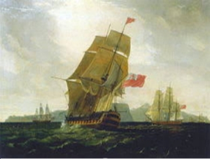
The Second Occupation
The British Fleet under Admiral Popham at the Battle of Blaauberg 1808
(Image ST Museum)
In January 1806 a force too strong for the weak Batavian forces to withstand took possession of the Cape once more for Britain. Within two or three months of the capture of the Cape all effective threats to the supremacy of the Royal Navy in southern waters were ended and their ships were again able to establish a blockade of the French islands, although it was not always possible to make the blockade entirely effective. The only complete solution of the problem was the capture of the islands, and measures to this end were put in hand. In 1810 Mauritius and Bourbon were captured and the fall of Tamatave in Madagascar in 1811 left the French without a single colonial possession. As a consequence there was little left for the ships of the Royal Navy to do in Cape waters and their number was soon reduced.
R.N. base moves to Simon’s Town
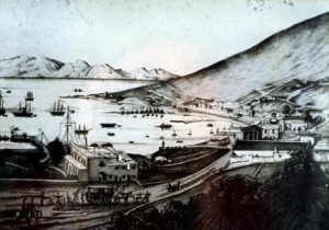
The Royal Navy in Simon’s Bay early 1800s
(Image ST Museum)
The naval authorities now had the leisure to give some time and attention to the consolidation of the base facilities. The removal of the whole naval establishment from Table Bay to Simon’s Bay and vice versa at six-monthly intervals was manifestly inconvenient and costly. It had furthermore become clear to the experienced seamen of the Royal Navy that Simon’s Bay provided a safe anchorage at all seasons, which Table Bay did not. The Commander-in-Chief of the Cape Station was emphatically in favour of removal of the principal base of the Royal Navy to Simon’s Bay and this was immediately accepted. The necessary buildings were completed in 1814. It was perhaps fortunate that this was accomplished before peace was declared in 1815, as it is doubtful whether the considerable expenditure would have been authorised in peace-time!
A period of peace
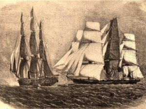
HMS Brisk captures Slave ship
(Image ST Museum)
Valuable as Simon’s Town had been in wartime, in the years of peace which followed it proved to be quite invaluable. The first important task laid on the ships of the Cape of Good Hope Station was the guardianship of Napoleon Bonaparte during the years of his detention on St Helena. With his death in 1821 the Simon’s Town Dockyard establishment was drastically reduced. A nucleus of trained staff remained to cater for the ships which continued to call on their voyages to and from the East. There were still a few ships on the Cape Station, including those commanded by the illustrious surveyors who in the 1820’s carried out the survey of the coast of southern Africa. Simon’s Town was their secure base to which they returned for refitting and recuperation. Much the same consideration applied to the small vessels employed in the suppression of the slave trade. In addition the cargoes of slaves in the captured slave ships, which could number up to seven hundred or more, were landed and housed in any accommodation available pending their allocation as indentured apprentices.
Coastal skirmishes
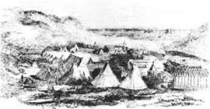
Waterloo Bay in the Eastern Cape
(Image SAMHS)
Nearer at home, the ships of the Royal Navy were in constant demand for the transport of troops and their equipment to the frontier during the many Native Wars of the nineteenth century. Algoa Bay, the Kowie and the Buffalo Rivers and Waterloo Bay provided convenient disembarkation points and each was provided with a resident harbour master and boats crew. All had to be supplied from the main base at Simon’s Town. It was on short coastal journeys such as these that steam driven vessels proved most suitable. For all ocean voyages sail remained the normal means of propulsion until the end of the nineteenth century.
Steamships and the Dockyard
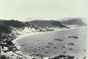
Early Steam Ships in Simo’ns Bay
(Image ST Museum)
It was around this time that improvement in steam propulsion began to make a real impact on the Cape Station and purely sailing vessels unaided by auxiliary steam power were becoming the exception rather than the rule. The installations in the Dockyard, which had not been altered in any way since 1814, proved quite inadequate to cope with the complexities of steam engines. The increasing use of iron in the construction of ships as well as their very size posed new problems in maintenance. Considerable extensions and reconstruction took place during the 1850’s and 60’s.
With the advent of reliable steam engines the smaller vessels were able to approach close in to the shallow bars of the east coast rivers in comparative safety. These little ships found themselves much in demand by missionaries and explorers. Such occasions also offered convenient opportunities for “showing the flag” in places not usually visited by ships of any kind and to act as a warning to any potential slave trader that the Navy’s arm was longer than ever.
The Anglo-Boer War
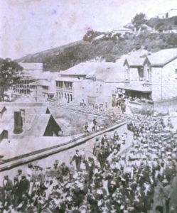
British Troops off to the Front
(Image ST Museum)
Throughout the Anglo-Boer War, Simon’s Town and Cape Town were the principal ports through which passed the reinforcements of men, supplies and equipment for the British Army. Without these the few British troops would have been overwhelmed by the superior numbers of the Boer forces in the first few months of the war. As it was the British were able to maintain an uninterrupted flow of men and ammunition from the United Kingdom and other parts of the British Empire, while the Royal Navy’s command of the oceans virtually prohibited all similar supplies reaching the Transvaal and Free State Republics.
There can be little doubt also that it was only the healthy respect for the Royal Navy which prevented Kaiser Wilhelm II of Germany from intervening on behalf of the Republics.
East Dockyard opened
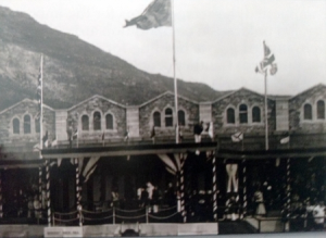
East Dockyard Opening Ceremony 1910
(Image ST Museum)
In the closing stages of the nineteenth century the resources of the Simon’s Town Dockyard were once again proving inadequate for the needs of larger steamships, but with the opening of the East Dockyard and Dry Dock in 1910 Simon’s Town once again became equipped to meet every requirement of any ship of the Royal Navy. It was not long before these facilities were urgently needed: in 1914 Great Britain and Germany were at war.
Simon’s Town during World War I
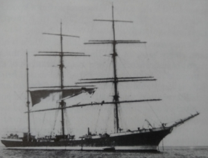
Captured German Barque, Simon’s Bay 1914
(Image ST Museum)
The part which Simon’s Town and the ships of the Africa Station were called on to play in this war differed in no respect from the part it had played in earlier wars. These tasks were the elimination of all enemy ships, especially commerce raiders, from the waters around the southern end of Africa and the elimination of all the enemy bases within its sphere. At the outbreak of war there were a number of German warships at large in all the oceans of the world; these included the Emden, the Koningsberg and Admiral von Spee’s powerful squadron believed to be in the South Pacific. Until these ships were accounted for no protracted expedition by sea against the German colonies could be contemplated without a powerful escort of warships. The Emden was destroyed at Keeling Island, the Koningsberg in the Rufiji River and von Spee’s squadron at the Falkland Islands. With all hostile warships satisfactorily disposed of, operations against the two German colonies of South West Africa and Tanganyika could now go ahead.
For the remainder of the war Simon’s Town spent a humdrum but busy and essential existence as a refueling and refitting base for the escorts of the numerous troop convoys passing between Europe and Australasia, India and the Far East. The most destruction in South African waters was done by the mine fields laid by commerce raiders off Dassen Island and Cape Agulhas.
At war again
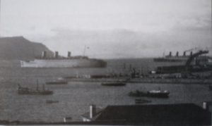
Troop ships in Simo’s Bay WWII
(Image ST Museum)
Simon’s Town activity followed much the same pattern in the Second World War as it did in the First. In the early stages of the war it was the assembly base for the ships engaged in the rounding up of the few German ships in the southern oceans, the most important of which was the Graf Spee. There followed other heavily armed raiders disguised as merchant ships, including the Atlantis which laid mines off Cape Agulhas and elsewhere. They operated with considerable success but were all eventually intercepted and sunk by ships based on Simon’s Town.
With the closing of the Mediterranean all traffic between Europe and the East had to be routed around the Cape as in former days. Although the merchant ships put into Cape Town for replenishment only Simon’s Town was capable of dealing with the special requirements of the warships. The entry of Japan into the war and their swift conquest of Malaysia and the East Indies intensified the vital role which Simon’s Town had to play.
In the latter stages of the war, with the reopening of the Mediterranean and the Suez Canal, Simon’s Town lost much of its importance as a staging post. By this time, however, the war in the southern oceans was virtually over and Simon’s Town’s mission was accomplished for the time being. It had done its task and done it well.
Postwar Simon’s Town
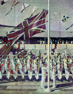
Lowering of the Union Jack 1957
(Image Cape Argus)
After the cessation of hostilities the tempo of naval activities slackened off. Following negotiations between the South African Minister of Defence and the British Government the Dockyard was handed over to the South African Navy in 1957. (The Union Jack that was lowered at the formal hand-over is now in the Society’s rooms). Ten years later, in 1967, Simon’s Town was proclaimed a White Group Area and over the next few years the coloured people, whose family ties sometimes went back to the very early days of the town’s growth, were moved away. Their houses in and behind the town fell into disrepair and a lot of them were eventually bulldozed flat: thus was part of Simon’s Town’s quaint attraction lost. The Historical Society’s efforts in preventing such destruction were to no avail, yet at the same time “Studland”, Admiralty House, St Francis Church, “Ibeka”, Palace Barracks and the Martello Tower were all proclaimed National Monuments. In 1975 the face of the town again started to undergo change when extensions to the Dockyard were started: a large area of land was reclaimed at Jaffa’s Beach and the harbour walls were extended further to sea to form a new and larger Tidal Basin.


